
This week, I visited the Bentonville [NC] Battlefield State Historic Site and was especially excited to examine some of the preserved fortifications on the battlefield. Bentonville is less than an hours’ drive from Raleigh and is well-known to Civil War enthusiasts here. For those of us who are studying the Raleigh earthworks, Bentonville provides some useful examples of what the remnants of Civil War fortifications might look like on the ground today.
I was surprised to learn that a National Park Service survey in the late 1990s found 15,000 feet of remaining earthworks on the battlefield. To me that’s a rich legacy left for those interested in Civil War fortifications. It also emphasizes to me the extent to which constructing earthworks had become a routine feature of Civil War battles by the time of the Bentonville battle (March 19-21, 1865). I’m sure that the 15,000 feet of remnants is probably a fraction of what was originally constructed there as the armies arrived and as the battle progressed over the three days.
The battlefield is encircled by a 10-mile driving tour that takes you to many of the key sites of the battle; it also walks you through a chronological story of the battle. However, some of the best and most accessible earthworks are within easy walking distance of the battlefield Visitor Center (point #2 on the tour map). These are a stretch of works built by the 1st Regiment Michigan Engineers and Mechanics, under orders from Maj. Gen. Alpheus Williams, commanding the Federal 20th Corps.

This photo taken from the plaque at a trailhead shows a somewhat faded map of the works identified in the NPS survey. It’s probably hard to read the specifics here, but you can tell from the pink-colored lines that the remaining works are substantial:

If you cross Mill Creek Church Road from the Visitor Center and then cross the field, you can enter a trail that leads through the woods to a loop trail along some extensive stretches of entrenchments. This loop is also accessible through an entrance at the point marked #6 on the battlefield tour map.
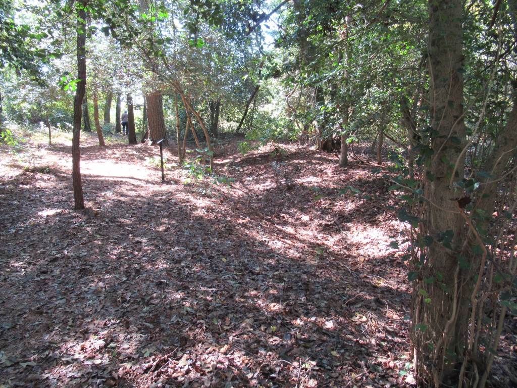
Here are some photos I took along the way. A two-dimensional image doesn’t quite do justice to the real thing, but at least you will get an idea of what can be seen along the trail:

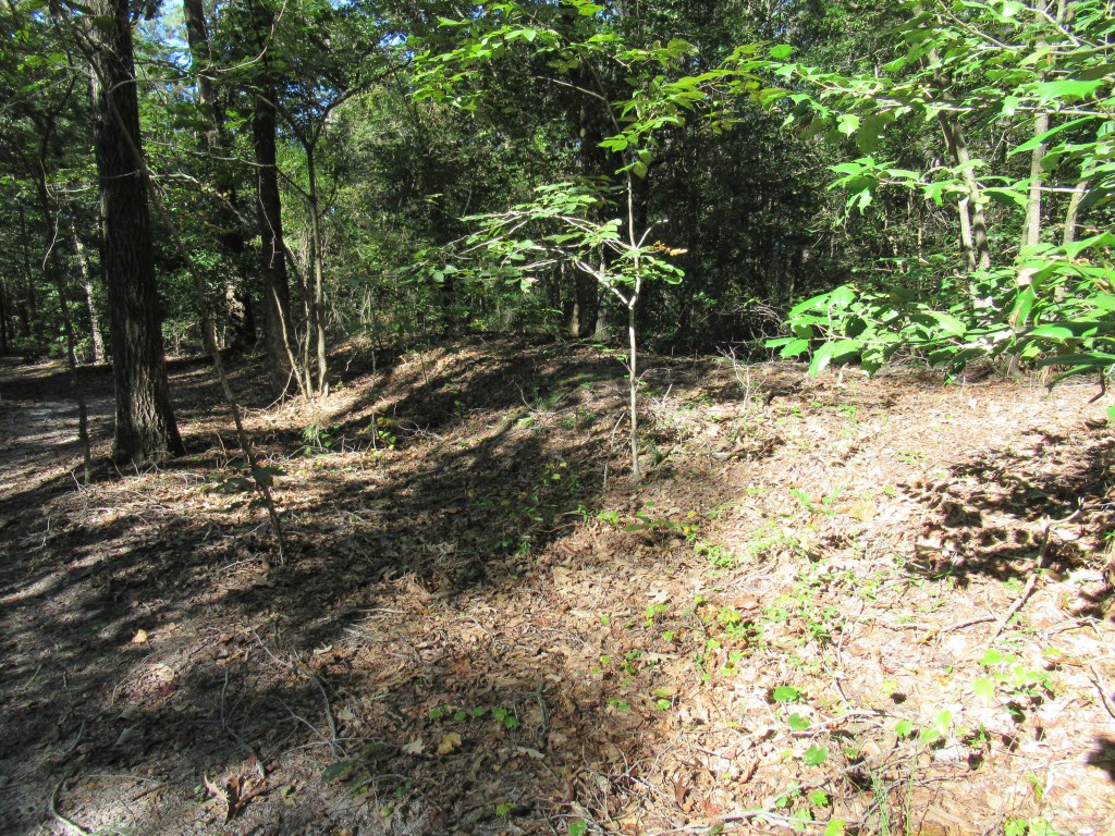


The Michigan Engineers works are at the southwest tail of the battlefield park. I also visited some earthworks at the northeast side of the battlefield, near the location of Gen. Sherman’s headquarters, marked as point E on the driving tour map. This was at the extreme right of the Union line on March 20, and the fortifications built there were apparently the work of 17th Corps, Army of the Tennessee, under Maj. Gen. Francis P. Blair.


In exploring the locations of the Raleigh fortifications, I’ve found little to compare with these Bentonville remnants. These field fortifications wouldn’t correspond in every respect to defensive works built around a city. The rural character of the Bentonville site has resulted in less disturbance of these historic locations, whereas most of the the Raleigh sites have been subjected to urban development. Also, as near as Bentonville is to Raleigh, Bentonville is in the southern coastal plain of North Carolina, with a flatter terrain and sandier soil than Raleigh with its central Piedmont location and clay soil.
All the same, perhaps there’s a lesson to be learned from examining preserved Civil War earthworks in other locations: A depression in the ground might be something more than just a hole or a ditch; and a mound might be something more than just a pile of dirt.
Please note: The Bentonville works can be seen from well-defined trails. I did not step on or walk into any of the works. I hope you won’t either!
A. Roy Bredenberg — 2 Oct 2020

Great Story!
LikeLiked by 1 person