
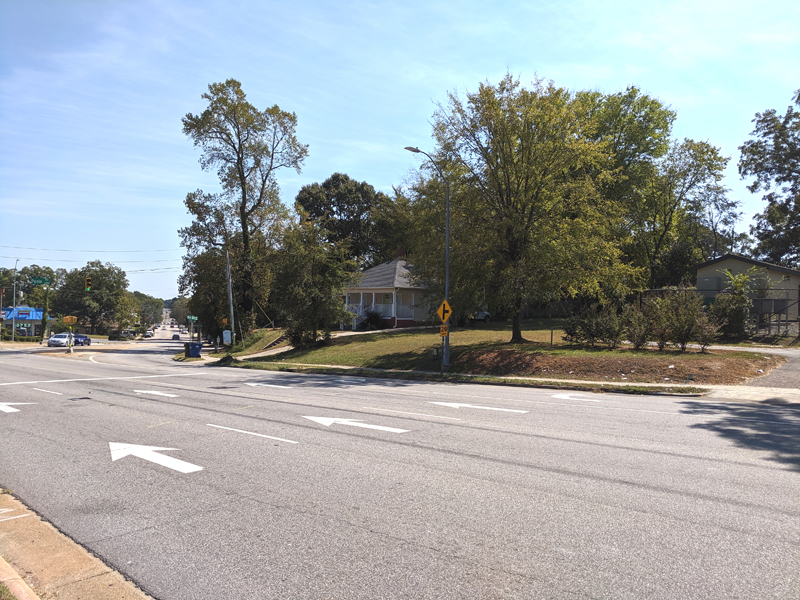
Recent mapping studies have confirmed that a mound visible near the intersection of New Bern Ave. and Poole Rd. in Raleigh, N.C., is in fact the remnant of a redan, or artillery platform, built during the American Civil War as part of the ring of defenses around the capital city. The mound has now been registered with the North Carolina Office of State Archaeology as archaeological site 31WA2558. The north end of the mound can be seen as a raised area with structures on it in this photo, taken from across New Bern Ave.:
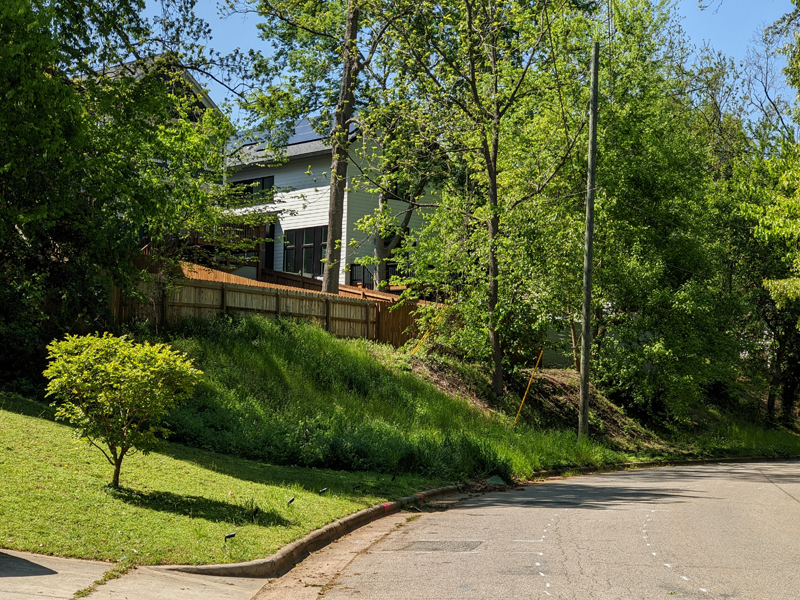
Another view of this same large mound can be seen in this photo, taken from Battery Dr. from the southeast of the mound:
This mound is almost certainly the land feature that gave its name to Battery Heights, a traditionally Black neighborhood in Raleigh platted in 1915. Part of the development was later built up after World War II and is now a Raleigh historic district. Bart Street, an L-shaped street on the mound, contains homes that might date back to the 1920s. Part of Bart Street runs parallel to New Bern and was marked on older maps as an extension of Morgan St.
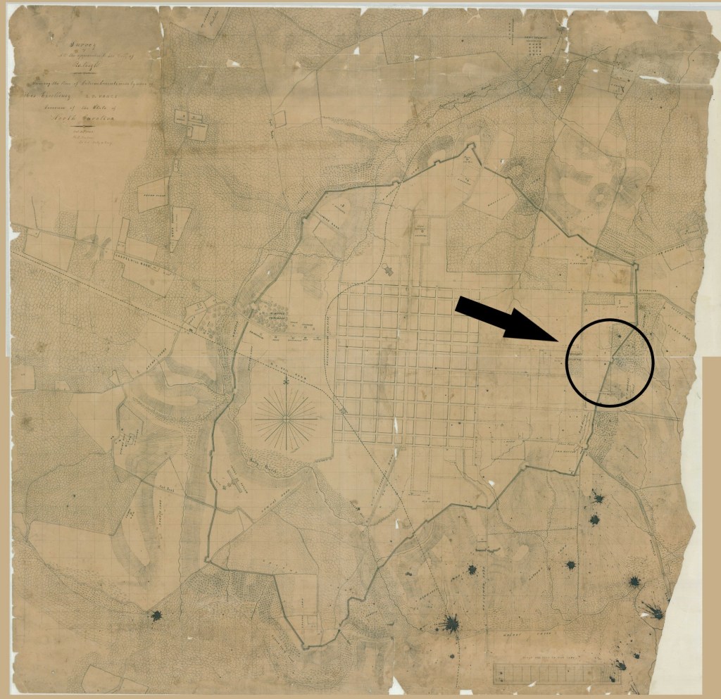
As explained in other articles on this website, Raleigh was surrounded during the Civil War by a rough circle of earthworks about eight miles in circumference, studded by a series of batteries, or redans. Mapping studies and field reconnaissance by myself and others has provided convincing proof that remnants of these fortifications still exist on the landscape today, including some above the surface, such as the Battery Heights Mound. Here’s the 1863 engineer’s map by Confederate Lt Col Henry T. Guion, with the Battery Heights location marked on the east side of the city:
The following detail shows that the battery was built on a mound to the east of Pettigrew Hospital (now a state property that housed the Department of Motor Vehicles until recently). At the time of the war, New Bern Ave. had not yet been extended as far as the battery location, but it can be seen that the battery (marked as “Redan and slope”) was adjacent to the eventual location of the street:

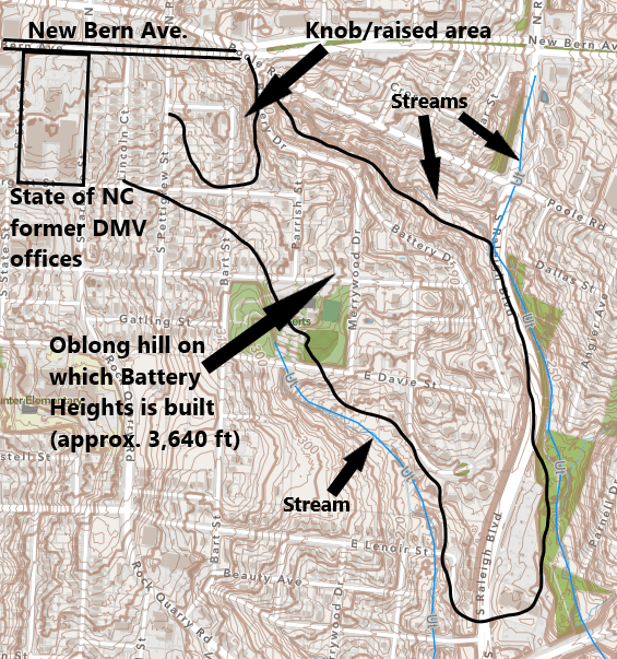
You can see that the artillery platform was built on a high mound at the head of a long hillside that curved around to the southeast. This is the same hill on which the historic area of the Battery Heights neighborhood was later built.
The following contour map shows the same land features nowadays, including the mound or knob on New Bern Ave., where the artillery platform was built.
This location is also confirmed by mapping studies done by myself and by the cultural resources firm Richard Grubb and Assocs. The following detail shows the entrenchment lines and the battery locations centered on the teardrop-shaped map points, as determine in the three studies. The black line is from my study (Bredenberg), and the red and blue lines are from the Richard Grubb studies:

This location is historically and culturally significant for several reasons:
- The mound represents one of the less-developed Civil War locations in Raleigh.
- The Raleigh fortifications are the work of some 300 free and enslaved Black workers impressed for the construction of the entrenchments and batteries.
- Post-war, the area might have been occupied by Union troops in the area after the surrender of Raleigh and during the Reconstruction period.
- The mound is in the area of an early African American neighborhood and might still retain small homes built during the early 20th century.
- Any of these aspects of the location’s history might be elucidated by archaeological study of this mound.
It is also noteworthy that significant construction has been proposed for the area of the Battery Heights Mound, which could disrupt the archaeological remnants possibly located here.
For those interested in or tasked with historic preservation in Raleigh, I suggest that the following activities could be fruitful:
- Undertake a thorough archaeological study of the entire mound area.
- Research the history of the existing homes on Bart Street and consider whether some of these should be designated historic structures and become targets for preservation efforts.
- Consider establishing a mini-museum on or near this mound, as well as educational signage focusing on the Civil-War, Reconstruction, and Black history of this area of Raleigh.
ARB — 12 Oct. 2022

That’s awesome! Thank you so much for the information. History is so amazing
LikeLike